Use Cases & Project Showcase
Discover how organizations worldwide are leveraging Accelara's space technology solutions to solve real-world challenges and drive innovation.
Project Categories
Earth Observation
2 projects
Agriculture
1 projects
Infrastructure
1 projects
Emergency Management
1 projects
Environmental
2 projects
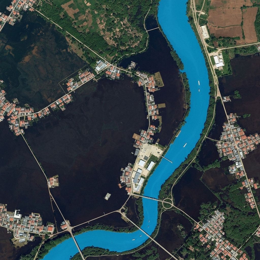
Urban Flood Monitoring System
Real-time flood prediction and monitoring system using SAR satellite data and AI agents for Mumbai's monsoon season.
Mumbai Municipal Corporation
18 months
Challenge
Mumbai faces severe flooding during monsoon season, affecting millions of residents and causing economic losses exceeding $1B annually.
Solution
- •Deployed FloodForecaster v1 AI agent with high-resolution SAR data
- •Integrated real-time precipitation nowcast from IITM
- •Custom dashboard for emergency response teams
- •Mobile alerts for citizens in high-risk areas
Accelara Components Used
Key Results
"The Accelara flood monitoring system has revolutionized our disaster preparedness. We now have unprecedented visibility into flood risks."
Chief Disaster Management Officer, BMC
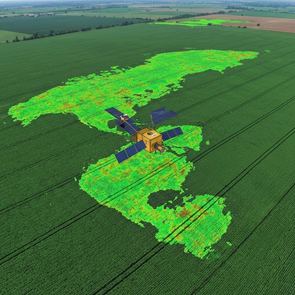
Precision Agriculture Optimization
Multi-spectral satellite analysis for crop yield optimization across 50,000 hectares of farmland in Punjab.
AgriCorp India
12 months
Challenge
Traditional farming methods resulted in 30% yield variations and inefficient resource utilization across large agricultural operations.
Solution
- •CropYield Predictor AI agent deployment
- •Multi-spectral satellite imagery analysis
- •Soil moisture and weather data integration
- •Farmer mobile app for recommendations
Accelara Components Used
Key Results
"The precision agriculture system helped us optimize our farming operations and significantly increase our yields while reducing costs."
Operations Director, AgriCorp India

Infrastructure Health Monitoring
Predictive maintenance system for metro infrastructure using vibration sensors and AI-powered analysis.
Delhi Metro Rail Corporation
24 months
Challenge
Aging metro infrastructure required proactive maintenance to prevent service disruptions and ensure passenger safety.
Solution
- •InfraHealth Monitor AI agent implementation
- •Vibration sensor network deployment
- •Asset registry integration
- •Predictive maintenance scheduling
Accelara Components Used
Key Results
"The predictive maintenance system has transformed our operations, allowing us to maintain service reliability while reducing costs."
Chief Technical Officer, DMRC

Disaster Response Coordination
AI-powered disaster response coordination system using satellite imagery and social media analysis for rapid emergency response.
National Disaster Response Force
15 months
Challenge
Coordinating disaster response across multiple agencies and locations with limited real-time information and communication.
Solution
- •DisasterResponse Coordinator AI agent
- •Real-time satellite imagery analysis
- •Social media monitoring integration
- •Multi-agency coordination platform
Accelara Components Used
Key Results
"This system has dramatically improved our ability to coordinate disaster response and save lives during critical emergencies."
Director General, NDRF

Smart City Water Management
Comprehensive water quality monitoring and management system using satellite spectral analysis and IoT sensors.
Pune Smart City Corporation
20 months
Challenge
Managing water quality across multiple sources and distribution networks while ensuring compliance with safety standards.
Solution
- •WaterQuality Monitor AI agent deployment
- •Satellite spectral analysis integration
- •IoT sensor network installation
- •Real-time quality dashboard
Accelara Components Used
Key Results
"The water management system has helped us maintain excellent water quality standards while optimizing our operations."
Chief Water Officer, Pune Smart City

Forest Conservation Monitoring
Large-scale forest monitoring and conservation system using time-series satellite analysis and change detection algorithms.
Forest Survey of India
36 months
Challenge
Monitoring deforestation and illegal activities across vast forest areas with limited ground-based resources.
Solution
- •Time-series satellite imagery analysis
- •Change detection algorithms
- •Automated alert system
- •Ground team coordination platform
Accelara Components Used
Key Results
"This monitoring system has been instrumental in our forest conservation efforts and combating illegal deforestation."
Director, Forest Survey of India
Ready to Start Your Project?
Join leading organizations worldwide who trust Accelara for their space technology solutions. Let's discuss how we can help solve your challenges.